Drone Scanning for Geological Survey
Capturing coastal geology via drone scanning and 3D printed models.
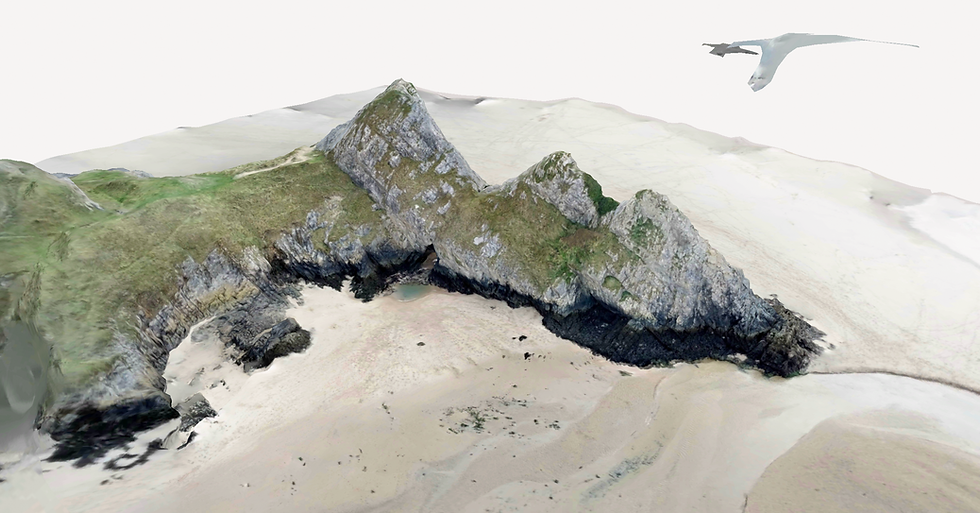
This project focussed on creating a proof of concept for using drones for geological surveying. After discussions with a Geology lecturer in Gower College about the endless possibility of using a drone to 3D scan rock formations, 3D print the scan and even creat a classroom AR experience from the scan, our Geology lecturer was on board. Before progressing further, the lecturer wished to see an exisiting proof of concept, before involving students. I visited a local Point of Interest (Three Cliffs Bay), sent the college drone into the sky and orbited the cliffs. From here I was able to upload this video into Polycam and create a Gaussian Splat. PolyCam provided the opportunity to turn the splat into an AR experience, but later this will be remade with Nianitics '8th Wall'. This splat was then reoptologised ready to be 3D Printed.
Project Gallery


